June 18-22, 2001
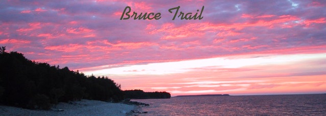
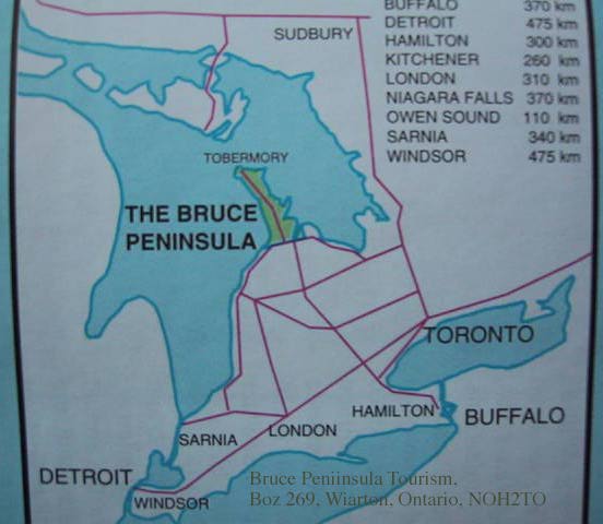
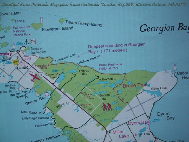
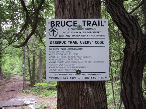
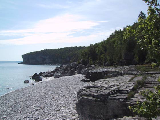
The Bruce trail is a 780 Km. footpath along the length of the Niagara Escarpment from Queenston Heights near Niagara Falls to the lake port and ferry dock town of Tobermory, at the end of the Bruce Peninsula, Ontario. Map link We hiked from the trail head in Tobermory out through Bruce Peninsula National Park to a few km. beyond Cypress Lake map link, then turned around and retraced our steps. This section of the trail is perhaps the most spectacular of the entire trail as it traces along the limestone cliffs and beaches of Lake Huron's Georgian Bay.
Note about camping: Bruce Peninsula National Park has designated back country campsites that you are required to pre-register for and stay in. As it worked out we did not do this. Our first night we hiked for less than two hours from Tobermory and expected that our campsite would be out of the park. I don't know if it was or not because there were no posted park boundaries. The second night we intended to camp at a designated site called Starvehaven which is east of Halfway Rock Point. It was a long hike there and because we passed several trail intersections we thought we may have missed it. The next morning we hiked for about ten minutes and there it was. Wednesday night we were in an auto campground, Thursday back at Monday's site and we drove home on Friday.
Monday June 18
I picked up Dick at 6 A.M. and we loaded his gear and
began the 10.5 hour, 480 mile trip to Tobermory. We drove southeast to Port
Huron, crossing the bridge into Canada and turning north to the Bruce Peninsula.
The peninsula is a mix of thriving farms and small touristy towns along the
Lake Huron shore. We stopped at the visitor center in Wiarton (pronounced
Wireton) where we purchased the Peninsula Bruce Trail Club Day Hike Guide.
The trail club also sells a book of detailed topo maps of the entire trail,
but it has a hefty price and you cannot buy just part of it, so we opted for
the day hike guide and it worked fine.
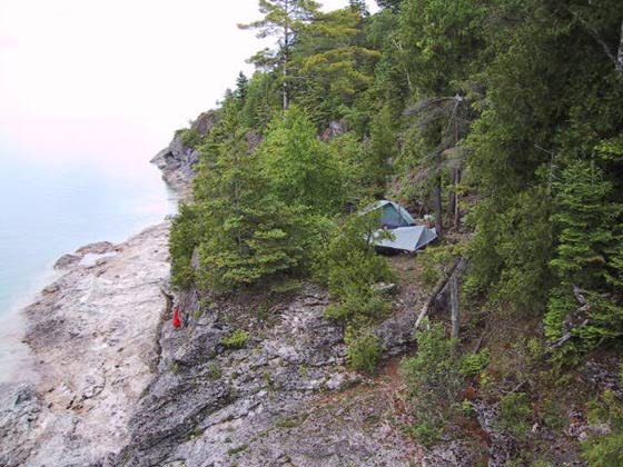
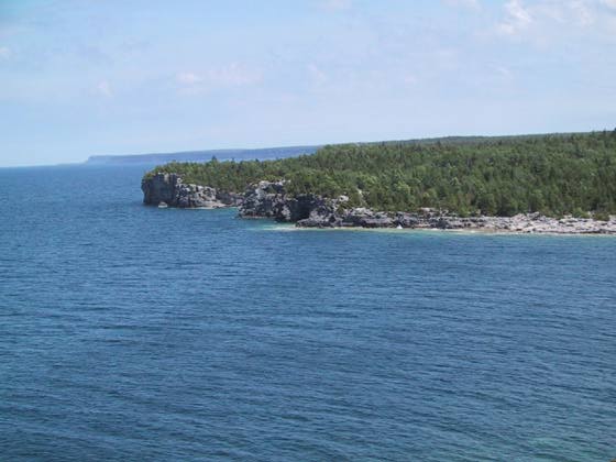
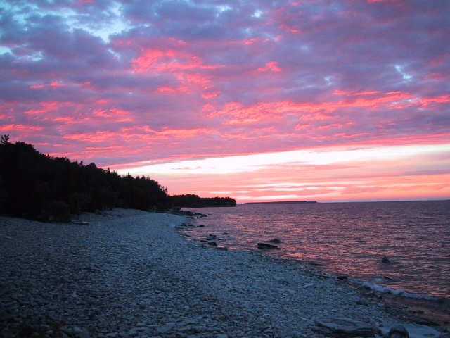
After arriving in Tobermory at 4:30 P.M. we found a restaurant for an early dinner, information about where the trail head might be and where we could park for a few days. The advice was to park in the municipal lot which was a short walk to the trail. There is a great board walk around the harbor where you can look back at the town and ferry dock. Photo . It is a two hour ride on the ferry to Manitoulin Island (north of Tobermory on the first map), where one can then drive to the mainland. At 6:30 P.M. we donned our packs and headed off down the trail to begin our little adventure. The trail begins in forest with a couple of road crossings as you head out of town, but after an hour or so we found ourselves on the low cliffs along Durk's Bay. Here at about 8:30 P.M. we found a shelf just big enough for my tarp and Dick's tent. The gentle sandy beaches of the Bruce Peninsula are all on the west side. Here on the eastern, Georgian Bay side it is all very rugged cliffs or beaches of limestone pavement or boulders and smaller rocks. As we discovered, the water on the eastern side is also notoriously cold compared to the western side.
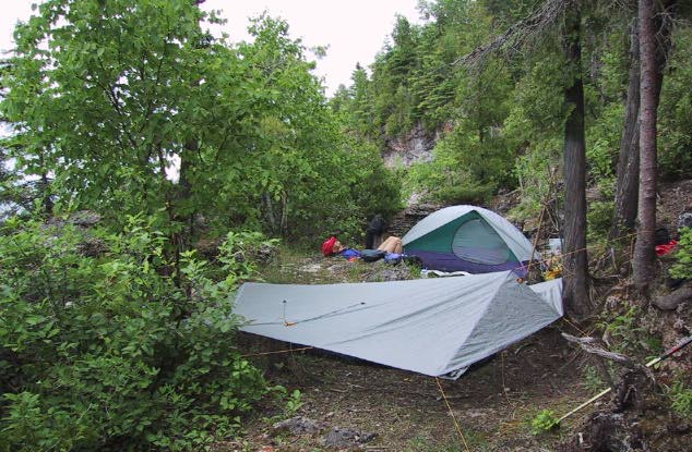
Those are our food bags hanging over the side of the cliff in the Camp photo.
Actually this photo was taken on our way back. On the way out I decided that
hanging the bag wasn't necessary and placed it next to my head beneath the
tarp. In the morning I found ground squirrel holes in three places. I obviously
had a sound night's sleep. Fortunately only one bag of gorp was lost. I did,
however, learn my lesson.
Tuesday June 19
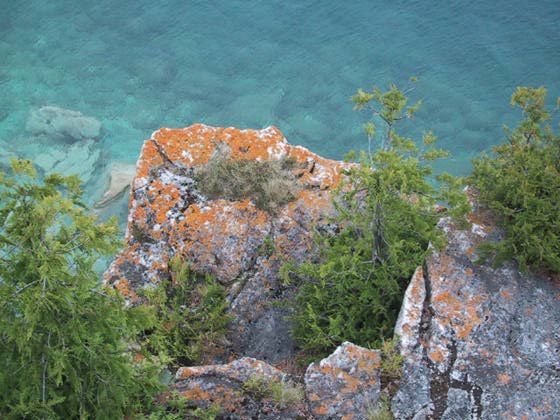
What a beautiful day. We hiked from 9 A.M. to about 5 PM with a sunny sky
and temperatures in the 70s. The summer season is just getting underway here
so we saw few people on the trail until the grotto, a cave under the limestone
cliffs, that is accessible to day hikers.
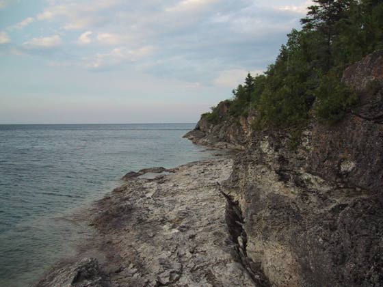
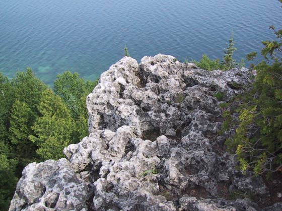
Looking toward Halfway Rock Point
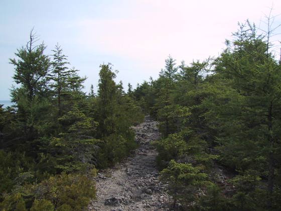
Typical Rocky Trail on the high cliffs
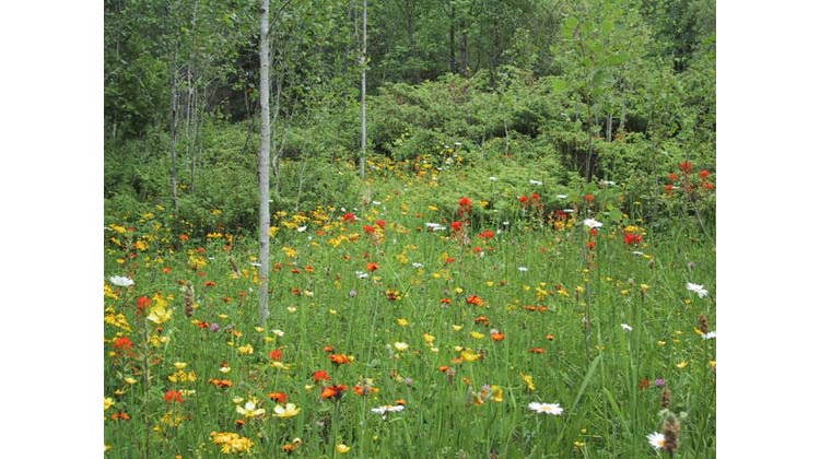
A meadow
of flowers:
paint brush, sneezeweed, clover, buttercups and daisies
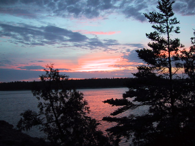
Tuesday night we camped in the trees above the lake just past a place called Halfway Rock Point.
Wednesday, June 20
This is turn around day. We hiked as far as Halfway Dump, ate lunch, then
turned around. Dump in this case is a term from former logging days and refers
to a place where logs were deposited for later processing and shipment on
the big lake. Since we were going to retrace our steps, Dick decided to stash
his pack for the morning and pick it up on the way back. I don't like to allow
my pack and contents to leave my sight so kept mine with me. Well we returned
to retrieve the pack and yes disaster did strike while we were away. It was
Dick's turn to learn that ground squirrels are more of a problem than bears.
There was a three inch hole in the top of his pack. For all their effort they
didn't get the food they were after. There had been food at the top of the
pack but Dick had since moved it to another spot deeper in the pack.
The weather was warm and sunny which brought out flies on the beaches and anywhere out of shade. As long as we kept moving or were back in the trees they weren't a problem. We selected our break sites with this, rather than scenery, in mind.
We decided to pass Tuesday's camp and spend the night at Cypress Lake campground; an auto camping area where we could swim in the warm inland lake and explore the trail around the lake. Of course, the camping wasn't as nice, but the park was only about 10-20% full so at least it wasn't crowded.
Thursday June 21
Knowing we had a lot of hiking to do, we were up early and on the trail by
8 A.M. The day was much cooler and a breeze kept the flies away. Clouds slowly
moved in as the day progressed. This was a day to meet other hikers, except
for one young couple, all were dayhikers and were Canadians. One group of
four included an 86 year old who was hiking right along, and another who had
day hiked the entire 780 km. length of the Bruce Trail. Yet another group
showed us where an accident had occurred the previous May. A tour boat had
taken a class of students and their teacher to Flower Pot Island which is
not too far off shore in Georgian Bay. When it came time to pick them up the
weather was terrible, but the guide set out anyway. They were picked up but
had not gone far when the waves capsized the boat. Fortunately most made it
to Flower Pot and safety, but two students did not make it. An investigation
was in progress.
Around 4 P.M. we arrived at the beautiful site where we had camped on Monday. We set up just before a gentle rain arrived. Dinner was cooked and eaten beneath my tarp. Rock overhangs were everywhere, so we took advantage of one of these to do a little reading as we listened to the gentle rainfall around us.
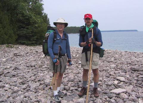
Comparing notes with other hikers
Friday June 22
Sometime after midnight the rain intensified. So we had a cold breakfast,
put on ponchos, packed up and made the short 1.5 hour hike to town and the
end of our trip. This is a beautiful peninsula and we feel privileged to have
been able to glimpse a bit of it.
Gear Report
I started with a pack weight of about 20 lbs. Including a base
pack weight of 8 lbs, 2 lbs in the fanny pack, 8 lbs of food, 2 for water.
Dick's pack weighed about 30 lbs. He wants to try my old tarp on our next
trip, saving him at least two pounds. My gear list for this trip pretty much
matches my summer gear list. I did weaken and take
a 3/4 length Therm-A-Rest as we expected to be camping on very thin soil over
very hard rock. It was a very nice luxury.
Food: As seems to be the case with me, I had at least enough food left for another day.
Pack: The Golite Breeze was great after adding sternum straps. (I used a bandana on the trip, but have since added straps). Without these the pack straps always rested at the same place on my shoulders.
Stove Fuel: 4 ounces plus a full Trangia stove. I had enough left for a couple more days.
Pants & Original Bug Shirt - Elite Edition. I am really pleased with this new item (the bug shirt). I rarely took it off and it worked perfectly while sleeping beneath the tarp at night. In a morbid sort of way it was kind of fun watching mosquitoes land on the fabric, sit there for awhile, then fly off. Just imagine their frustration! I began packing my Cloudveil Cirque Pants in my fanny pack. If there were bugs at a rest stop it was a very quick process to slip on the pants for complete protection. The side zips on the legs made it easy to put them on over hiking shoes.
Rab Elite Top Bag and Integral Designs Pertex Endurance Bag Cover/Bivy: What a great combination these two are. Night time temps. were in the 40s and I was very snug. I did not need any additional ground sheet. By placing the Therm-A-Rest between the bag and bivy I had no chance of sliding off my mattress in the middle of the night.
Aquamira Water Purification: I carried two 1 L. Dasani Pure Water bottles which slide in and out of the pack side pockets a little easier than do 1 L. Platypus bladders. Water was, of course, always plentiful and clear. This was a very hassle free and lightweight way to go. I never used the extra 2 L. Platypus bladder that I carried.